
Section 1 – North Berwick to Dunbar Station
- Total ascent: 277 m (909 feet)
- Length: 27.1 km (16.85 miles)
- Max elevation: 48 m (157 feet)
- Min elevation: 0 m (0 feet)
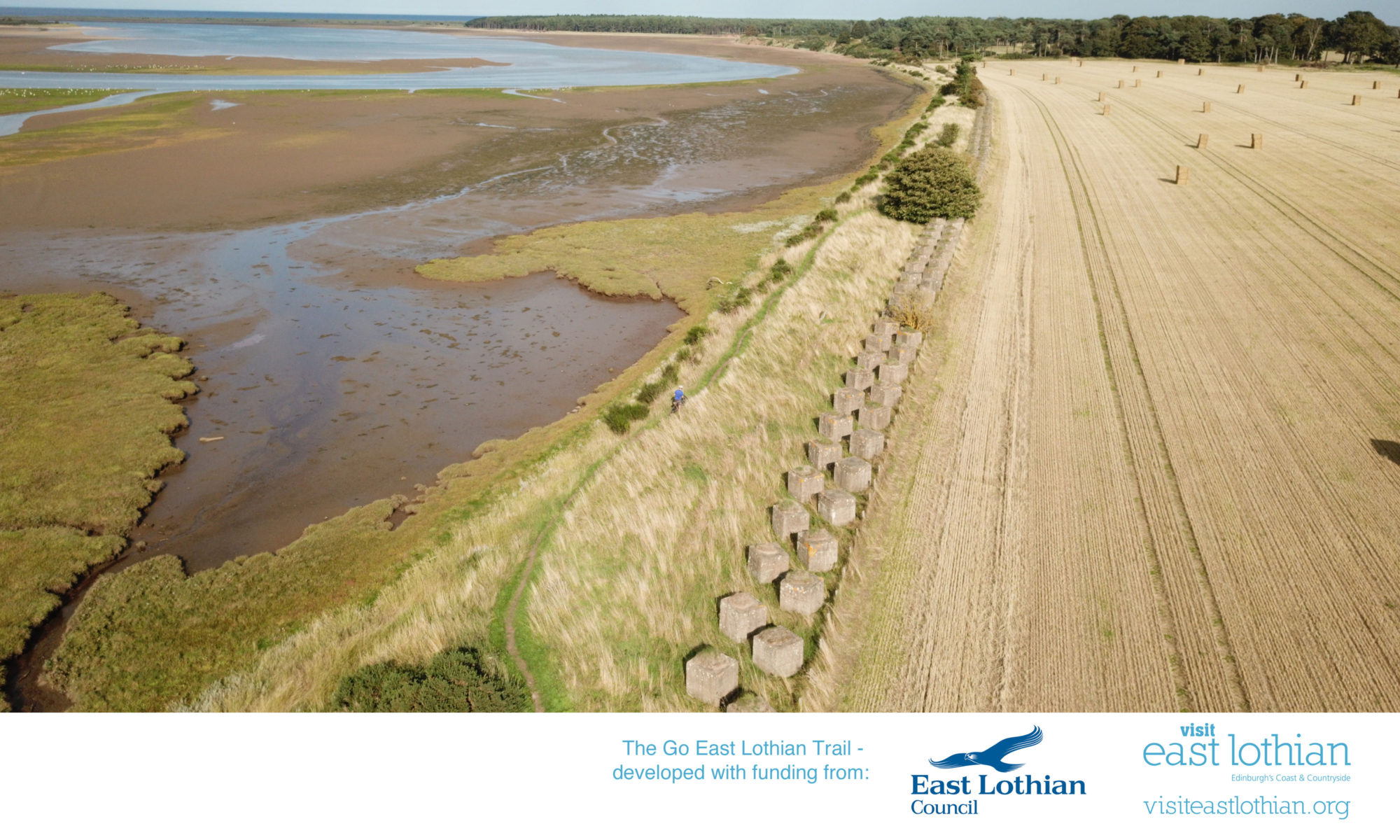
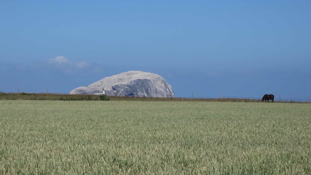
The Go East Lothian Trail starts at the harbour in North Berwick, where the café at the Scottish Seabird Centre and other eateries offer great opportunities for a snack before the ride. North Berwick is a vibrant and scenic harbour town in East Lothian, boasting great beaches, and an eclectic mix of shops, cafes and bars, not to mention world-renowned golf courses. Gilsland Park is a great base for anyone wanting to stay for the night, with family studios and more basic glamping pods to hire. From the harbour the route follows the road eastbound along the beach before a short climb takes you into Tantallon Caravan Park. Take care while riding through here, as this is an active golf course. The next section of the trail runs on the A199 to Drift, a new café overlooking the stunning cliffs on the coast. This is the best place for views towards the magnificent Bass Rock, the world’s largest colony of Northern gannets. After another short section on the public road the trail continues after Auldhame on a private road, taking you past Tantallon Castle to Seacliff Beach. Take care when descending on the gravel road towards the beach, which is popular with horse riders, kayakers and walkers. From the car park a small road climbs back up again, continuing past Scoughall to Peffer Sands and Ravensheugh Sands. The dunes and beaches here are brilliant for a short walk, before the route joins a minor road at the car park at Tyninghame, which is the starting point of a variety of walking and cycling trails. The route follows a quiet road and then travels a short bit on the A198, before joining the B1407 towards East Linton. The Tyninghame Smithy is a popular stop for cyclists, offering great food and refreshments. From here the route continues on the B1407 for a short while, before joining the John Muir Cycle Way on the left. Crossing Dawes Ford can be dangerous, a bridge on the left makes the crossing much safer, before the route leaves the John Muir Cycle Way and joins the A198 again. It joins a rough gravel track on the right shortly afterwards, linking with the John Muir Way at Hedderwick Sands. You’ll cycle past a wetland on your left and concrete constructions on the right, which served as anti-tank barriers during World War II. After crossing a wooden bridge, the route follows a sandy track trough a pine forest and past East Links Family Park, a popular destination for families, and past public toilets. From here the route continues on a track to Beilside and along the Biel Burn, before joining NCN 76 through Belhaven, past Belhaven Brewery. The route follows NCN 76 into Dunbar, and then takes a right turn to join Belhaven Road (A1087). Shortly afterwards you’ll find Belhaven Bikes on the left in a service station, which offers bike services and hire bikes. The route joins NCN 76 again in the centre of Dunbar, and then leaves the NCN route again on Countess Road, where a small road takes you to the train station on the left.
Further Information:
Dunbar Camping & Caravanning Club Site
Additional Bike Shops in East Lothian